« May 2005 | Main | July 2005 »
June 28, 2005
Nevada
On Monday morning June 13th we headed straight south from Jerome on US 93 to Wells Nevada where we turned west on I-80. The land we have come through has gotten progressively drier and from the flat plains of the Snake River we are into much hillier terrain. There is still snow on some of the mountain tops but they are not rugged like the ones north of Arco ID.
We had heard that travellers were welcome to stay overnight in WalMart parking lots so we decided to stop at the store in Winnemucca NV. It’s not where we will stay most of the time but it sure is nice to know that it is available – and it’s free.
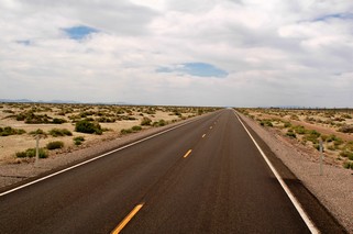 On the way to Carson City, the capital of Nevada, there are many “lakes” but they had no water in them. Only when it rains do they fill up for a short while. We turned off the Interstate and went south through the Carson Sink which is the most desolate, dry and parched area we have ever seen. The road ran dead straight with no elevation changes for close to 30 miles. I wouldn’t want to be lost out there as there doesn’t appear to be any landmark to help you.
As we had only driven about 170 miles (and we were on the road early since we were in WalMart’s parking lot and their PA system started about 6:30) we got into Carson City and set up by shortly after noon. On local advice, we decided to take the Kingsbury Grade road over the mountains to South Lake Tahoe. Let me tell you, it’s one steep “grade” with many 25 MPH curves and we were very glad that we were not towing the trailer.
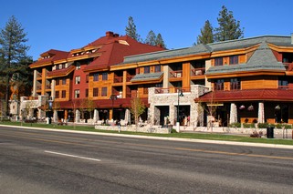
South Lake Tahoe is quite commercial and access to the beach is not very easy. The town itself if really pretty with the structures all made of materials to suit the environment. This picture is of the Marriott Grand Mansion Hotel and is typical of the buildings. The homes are quite beautiful and certainly are not what one thinks of as a cottage or cabin. The temperature at the lake was about 10 degrees F lower than in the valley.
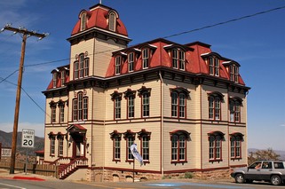 Even as easterners we had heard of the Comstock Lode, so since we were close by, we visited Virginia City where gold was found in 1870 and silver shortly after. The hills surrounding the town poured an estimated $400,000,000 into the economy, some of which was used to build San Francisco and also to help finance the Union Army during the Civil War. At one point it had a population of 30,000 with 100 saloons, many churches, banks and theatres – and the only elevator between Chicago and San Francisco. Today the population is about 900. We followed another mountain road back.
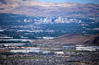 The view to Reno in the valley was great.
With dire prediction about a storm and high winds approaching from the Pacific we decided to stay put in Carson City for an extra day. The road in the valley to Reno is closed when there are high winds. The storm never materialized on the east side of the mountains, although there were banks of clouds over the peaks all day.
Did I say we did a little gambling? It’s a strong person who could go to Nevada and not put a quarter or two into the slots. Sorry, we didn’t win.
In Reno we stayed quite close into town so could walk to a couple of the bigger casinos. Went downtown and walked around but it really is just a smaller Las Vegas. 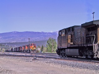 On Sunday we did go up to Truckee, then on to the north side of Lake Tahoe. Truckee is a wonderfully restored historic town but of most importance – IT’S a TRAIN TOWN. We were there when an eastbound Union Pacific and a westbound BNSF (Burlington Northern Santa Fe) met followed shortly by Amtrak’s California Zephyr. Ross had his train fix for the day (week?).
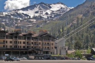 Just south of Truckee is Squaw Valley, site of the 1960 winter Olympics. It seems to suddenly appear out of the thousands of pines hugging the road. Of course, since it is summer, there is very little going on. We then followed the road to Tahoe City and on around the north side of Lake Tahoe.
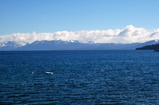 From the north road we could see the lake much better and it is very large – 22 miles long and 12 miles wide. At its deepest it is 1,645 feet and is at an elevation of 6,229 feet. The lake is a very beautiful blue and is rimmed by mountains.
Tomorrow, Tuesday June 21st, we’re heading to California.
Posted by Bernice at 10:54 PM | Comments (0)
June 27, 2005
Idaho
We left Yellowstone on June 8th and headed south into Idaho – and we found sun!!
We also almost found a moose in our front seat.
As we came over the brow of a hill she ran from the left ditch across the road right in front of us. We can now tell you with complete assurance that the truck brakes are working and they stop the truck and trailer with no problem. We missed her by about 10 feet.
An interesting visit to the museum in Rexburg Idaho explained about the breaking of the Teton Dam in 1976 in the mountains to the east of the town. It was an earthen dam (like the one in Garrison ND) that sprang a leak and then collapsed releasing 81,000,000,000 (that’s billion) gallons of water. There were only 11 deaths in the immediate neighbourhood of the dam as the downriver towns had warning of up to an hour.
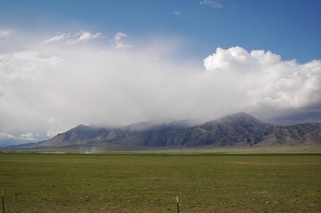 From Rexburg we went west, on local roads, across the north part of the Snake River Plain as we were headed for Arco right at the foot of the Lost River Range of mountains. It’s the closest town to the Craters of the Moon National Park, an area where lava rivers once flooded the surrounding countryside, leaving huge lava fields. The most recent lava flows were only about 2,000 years ago.
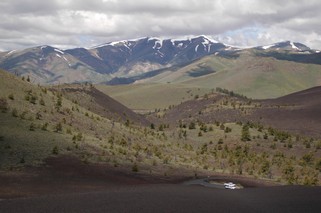
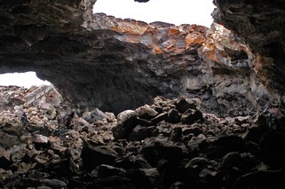
We drove a loop road in the park and hiked various trails, including climbing Inferno Cone for a fantastic 360 degree view. In the picture you can see our truck down below (it’s the white spot). We saw many misshapen trees, weird lava rock formations,
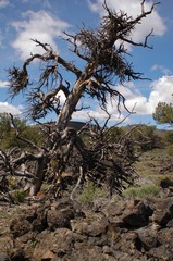
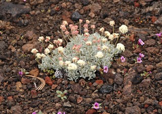
piles of lava and lava tubes that we climbed down into. With all the rain they have had this year even the lava fields are in bloom.
Behind the town of Arco is the “hill with the numbers”. Each year since 1920, the high school graduating class has painted their class year on the rugged cliffs.
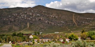
Before we left the area we visited the Experimental Breeder Reactor #1 in the desert about 20 miles from the town. In December 1951 it was the first atomic reactor to generate a usable amount of electricity and in July 1955, Arco became the first city in the world to be lighted by atomic energy.
In this area you will find both the Big Lost River and the Little Lost River that originate in the mountains to the north. They both flow to the lava beds and disappear into the ground. Apparently they show up again at Thousand Springs in the Snake River Canyon near Twin Falls, where the water comes out of the canyon walls.
We decided to follow the rivers and headed south stopping in Jerome on the north side of the Snake River. We figured that we would only stay one night but ended up spending 3 as we found the area so interesting.
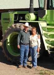
Sometimes it pays to have no plan. Sunday afternoon we took off into the country to the east of Jerome. Of course, when you don’t know where you are going you can’t be lost but when you are on a dead end road and go to turn around you sure look like you are. That’s when a couple in a truck stopped and offered us assistance. We explained what we were doing, they invited us to their ranch house to give us suggestions on what to see and they ended up spending the whole afternoon driving with us to show us the area.
Tim and Jan – thanks for making an ordinary day special. We’ll be back to visit you again one day.
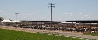
We found out that there are about 200,000 dairy cattle in the county. The farms have as many as 10,000 head and milking is a 24 hour production line 7 days a week. We actually went in to one farm and watched one set of cows being milked. Jan purchases day old calves and raises them to market weight of about 800 lbs. She had to be home about 6 PM to feed her “babies.
Tim continued with us to Niagara Springs, the most beautiful sight with 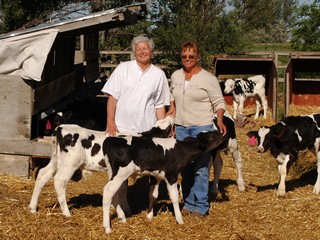 the water bursting out of the SIDES of the Snake River canyon. All along the bottom of the canyon there are fish hatcheries. A portion of the water from the springs is funnelled through the hatcheries and on into the river. About 80% of the rainbow trout sold in the US are raised in the river canyon hatcheries. Another interesting fact we learned was that the north side of the canyon has springs that are at 58 degrees F all year and the south side of the river has thermal springs that are used to heat the houses that sit close to them.
We also had the BIGGEST ice cream cones ever!!
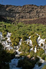
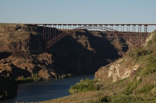
Monday, June 13th we headed south to Nevada – still in sunshine.
Posted by Bernice at 10:55 PM | Comments (0)
June 20, 2005
Some more pictures of Yellowstone
Yellowstone was so interesting that we decided that we would send out some more pictures of it
Hot springs & geysers are all over and in every colour and every consistency, from steam to water to mud pots.
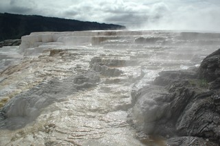
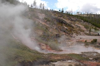
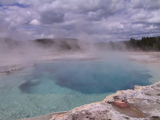
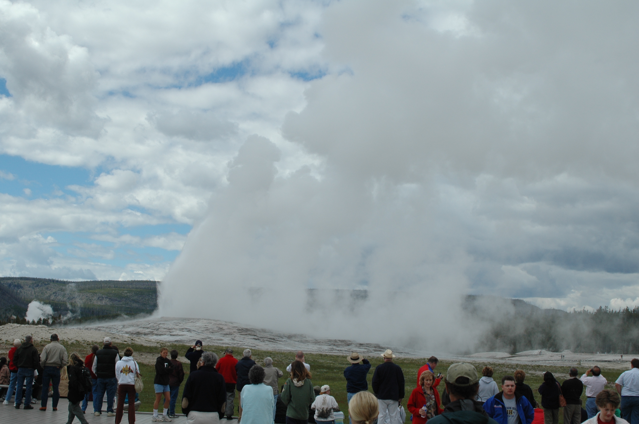
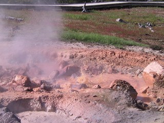
The fire of 1988 still is very much in evidence – however, because the new growth of lodge pole pines is only 3 to 8 feet high the vistas can still be seen.
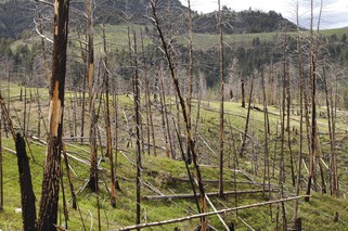
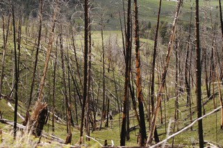
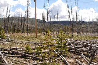
And the vistas are wonderful
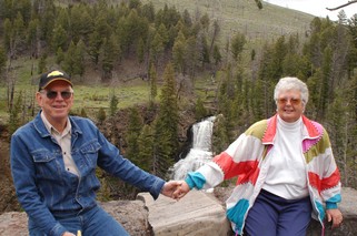
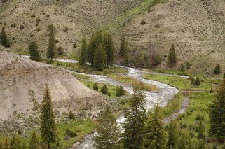
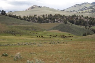
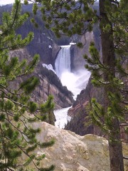
Now on to Idaho – stay well everyone and keep those comments coming. We love hearing from everyone.
Ross & Bernie
Posted by Ross at 12:25 PM | Comments (0)
June 18, 2005
Montana
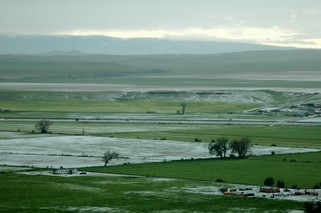 Tuesday morning, May 31th, we headed west on the Interstate into Montana in the pouring rain. From Billings Montana the next day we went to the Little Bighorn Battlefield Historic Site, where the battle between the US 7th Cavalry (General Custer) and the Sioux, Lacota and Cheyenne Indians took place in 1876. The tour provided by a Crow Indian guide at the site was very interesting and informative as it was presented from the perspective of the Indian. While we were there the most spectacular storm arrived. We were in the visitor’s centre attending a presentation by a park ranger and watched its progress across the valley with wild winds, heavy rain and hail. Initially we could see about 18 miles and when it finally arrived we could see only a few hundred yards. Unfortunately, the camera was in the truck so no pictures. After it passed, we went back up the trail and took some pictures of the hail that had come down. It looked like it had snowed.
We had considered going to Yellowstone over the Beartooth Pass, but in the 10 days before there had been 12 landslides covering the road. The state does not expect it to be open all this summer and will take about 20 million dollars to repair. That’s how much rain they have had this spring but everyone is still saying that it is not enough as they have had a 5 to 7 year drought.
From Billings on Thursday we went west and then south at Livingston through Paradise Valley. It is a wonderful green and fertile valley between two mountain ranges. For the next couple of nights we stayed in Gardiner at the north entrance of Yellowstone Park and then stayed for two nights in one of the park campgrounds.
Yellowstone is an amazing place. The north is mountains, wide valleys and sweeping hills; south is lodge pole pine, geysers, hot springs and mud pots and the center is a beautiful deep canyon and more hot springs. Then there are waterfalls seemingly whereever you look. We actually had sun on Saturday afternoon and Sunday.
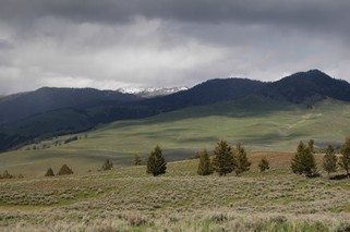
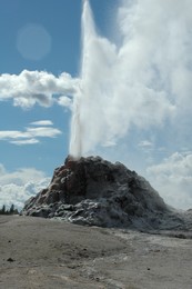
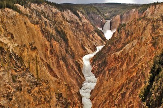
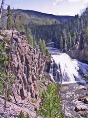
There are animals everywhere; some singly some in herds – buffalo, elk, mule deer, mountain sheep, bears, a coyote and a bald eagle.
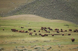
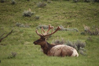
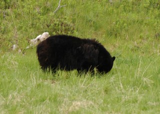
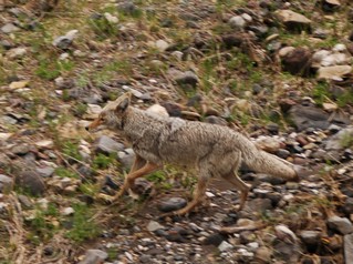
We left Yellowstone Monday morning June 6th. Again it was raining and cold and we decided to only travel just outside the park to West Yellowstone to have a day of rest. We had had a few very busy days in the park as we had hiked numerous trails to see the various points of interest.
At this point we were extremely tired of the rain and cold. Tuesday morning we woke up to a snow storm and had to scrape snow off the steps when we went outside. That confirmed our inclination. We decided to head into southern Idaho and the Snake River Plain to try to find some warmer weather. After that we will probably go further south into northern Nevada as we have never been to that area. The weather channel says that we should find some sun – we hope so.
Ross & Bernie
Posted by Ross at 05:07 PM | Comments (0)
June 11, 2005
Manitoba to North Dakota
On Friday May 27th we headed west in Manitoba along Highway 2 to Souris. 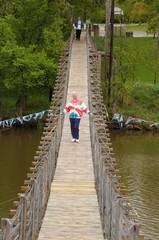 This town is on the Souris River which flows into the Assiniboine. One of the well-to-do residents in the early 30s built a swinging foot bridge over the river so that he could easily get into the town. It still stands today and at 582 feet is the longest swinging bridge in Canada. The town now keeps it in very good repair and it was used constantly by the residents during our time there.
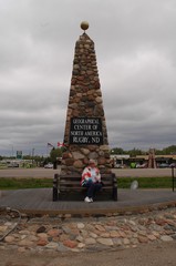
We headed south into North Dakota to Rugby, the geographical centre of North America, and then west to Minot. On Saturday we went in to Minot so Ross could do some train watching as it is a junction point for the CPR and Burlington Northern Santa Fe. We arrived at the station just as the Amtrak “ Empire Builder” arrived on it’s way west. We were surprised at the large number of people that boarded it there.
On Sunday we went south to the Garrison Dam on the Missouri River, which caused the formation of Lake Sakakawea. The lake is named after the young Indian girl who was the guide for the Lewis and Clarke Expedition. This is the 200th anniversary of the Expedition and all along the route there are celebrations, special events and a lot of hoopla. Apparently there has been a drought in the Midwest for the last number of years and some of the states down river are taking legal action to try to force North Dakota to release more water through the dam. The water level in the lake is already about 30 feet below normal. The dam is huge – it is earthen and is over 2 miles long, 1/2 mile wide at the base, 276 feet high and 60 feet across at the top. The highway runs across the top.
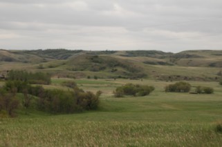 At this point we are seeing quite different landscape from the prairies of Manitoba. The hills appear as if some giant took shovels full of earth and haphazardly threw them around. They are grassland and there is very little cultivation.
Sunday night outside Bismark ND we had our first experience staying at a Truck Stop overnight. It was behind the building and certainly not the quietest location but all we did was sleep there so we didn’t need anything fancy. We have found the 5r to be very soundproof and it proved itself that night. It cost us $10.00 US and we had full hookups (water, electricity, sewer). That is cheap as we are probably averaging around $26.00 Cdn.
It has been raining most of the time we have been on the road and continues to do so. I must admit that we are getting very tired of wet and dull. Also, as you can see, none of our pictures are very bright without the sun.
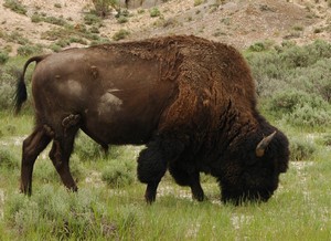
On Monday we headed out toward the North Dakota Badlands and set up in the town of Medora just outside Theodore Roosevelt National Park. A real western town on the Little Missouri river – population 100 permanent residents.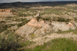 Tuesday we spent touring the Badlands and encountered a buffalo right at the side of the road. There also were a number of very large prairie dog towns with hundreds of burrows and dozens of animals. This land is very stark, beautiful and dramatic. Many coloured layers can be seen in the eroded cliffs and ledges but there is also grass that supports wildlife. This was one of Roosevelt’s favourite areas and he was instrumental as a conservationist in the formation of this park as well as Yellowstone and others.
On a cliff overlooking Medora is the “Chateau de Mores” , a “hunting cabin” built by a French Count. It has 10 bedrooms, 4 room owners suite plus kitchen, pantry, parlor and formal dining room. It has been completely restored even to original wallpaper. His meat packing plant failed and thus the house was used only for about 3 years.
Tomorrow, Tuesday the 31st, we head out for Montana. Stay tuned
Posted by Ross at 09:42 PM | Comments (0)
June 07, 2005
Spirit Sands Provincial Park
Greetings to you all
One of the neatest things about travel is finding something special you have never heard of or didn’t know existed. That is what happened is this case and so it’s a treat for us to bring you this chapter of Whites RV Journal.
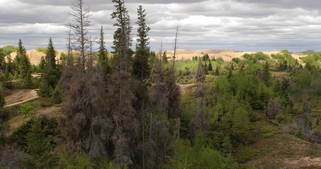
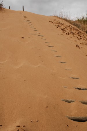
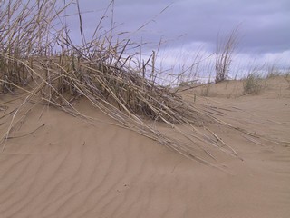
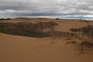
In south-central Manitoba is Spruce Woods Provincial Park and its feature attraction is the desert called Spirit Sands. “In aboriginal beliefs, the cardinal points – east, south, west and north – were more than directions. Each orientation is of special significance on the Medicine Wheel: a symbol of life and the universe that has many interpretations. One view identifies the East as the Place of the Beginnings; South, the Place of Plenty; West, the Place of Endings and North as the Place of Wisdom. Many other aspects of life and the world are represented in the oneness of the Medicine Wheel. The somewhat circular shape of the Spirit Sands is reminiscent of the Medicine Wheel. Since the landmarks ahead may not be as familar to you as they were to early travellers, take your bearings from this platform and establish some benchmarks for the hike ahead. You are about to enter the Spirit Sands from the east or east gate.”
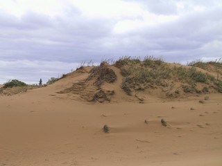
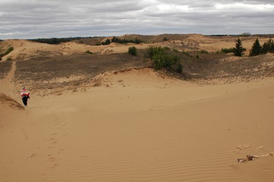
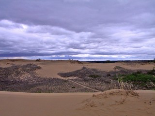
Although technically not a desert because it receives double the amount of annual rain/snow allowed for a dessert, Spirit Sands is in all other repects a dessert. Originally over 6500 square miles, the last reamining obvious section is only 4 square miles, as nature reclaims the area with first the growth of grasses, then shrubs and finally forests. As we walked through it on a cold blustery day, it was easy to understand how you can get lost in a dessert.
Here are a selection of photos for your enjoyment.
Posted by Ross at 05:55 PM | Comments (2)
June 02, 2005
Manitoba
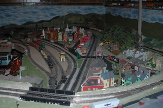
We arrived in Winnipeg on Thursday May 19th. We planned on being there for the long weekend as there was a model railroad convention that Ross was attending and Bernice was attending the Spectra staff BBQ on Friday. Spectra is the Property Management software system that Bernice’s former employer has used for about 6 years.
 Friday was glorious – sunny and hot ( about 31C ). In the afternoon we went to the Forks in Winnipeg. It’s where the Assiniboine and Red River meet right in the heart of the city. It was the old CN rail yards and the buildings and grounds have been converted to a wonderful recreation area. Thank goodness we went there on Friday as Saturday was a constant downpour – flooding a lot of the low ground
Some of the weekend was spent visiting model railroad layouts, seminars and a group supper. There were about 290 registrants from as far away as Austrailia.
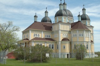
We went north on Sunday to Grand Beach on Lake Winnipeg listed as one of the 10 best beaches in North America. On the way north we came upon a magnificent Ukranian Catholic cathedral built in 1933 in the little town of Cooks Creek.
 Winnipeg itself has hundreds and hundreds of elm trees. Many are banded with metal that apparently is an attempt to prevent the carriers of dutch elm disease from infecting the trees. Also, all over the area you see signs “Prevent Dutch Elm Disease” “Do not burn elm firewood”. The “Service Brake System” warning light came on for the second time (the first while we were still in Ontario), so Tuesday AM Ross was at a local Chev dealer. Everything’s OK now, but you want good brakes when you’re pulling a 6 ton trailer at 100 kmh.
Wednesday we left for Spuce Woods Provincial Park in south central Manitoba to see the desert (ya right) there. We’ll have a complete seperate photo report of this beautiful area next.
Posted by Ross at 11:14 AM | Comments (2)